Main Line Tunnel Berlin
Client
Deutsche Bahn
Task definition
Image and profile recording as documentation of the actual condition
Measurement
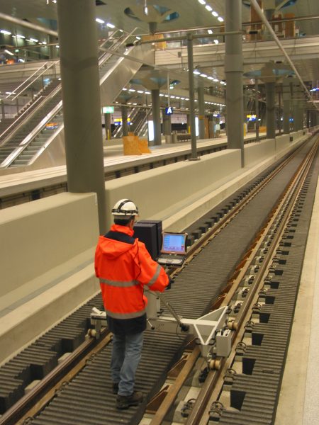
- Image recording with the TS2
- Total length of 8.39 km
The project in detail
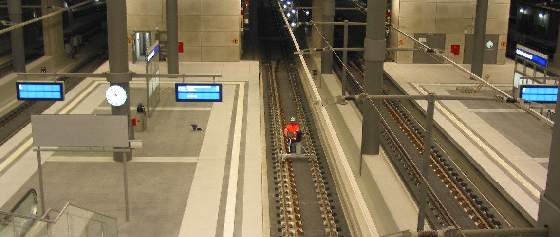
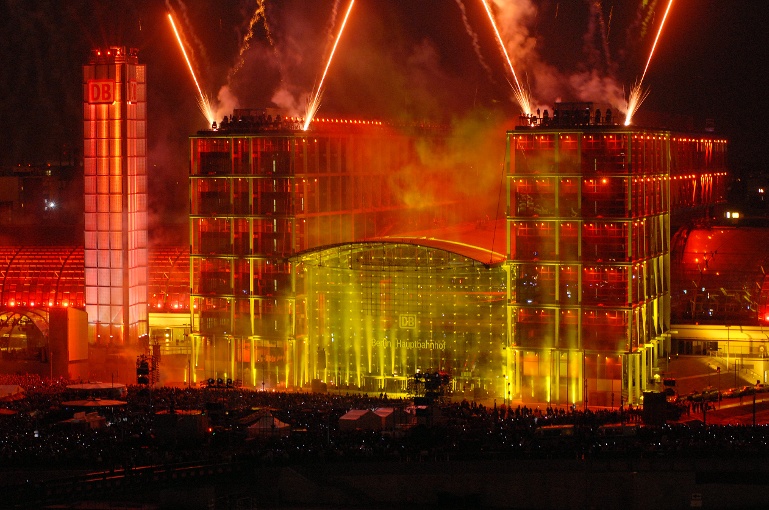
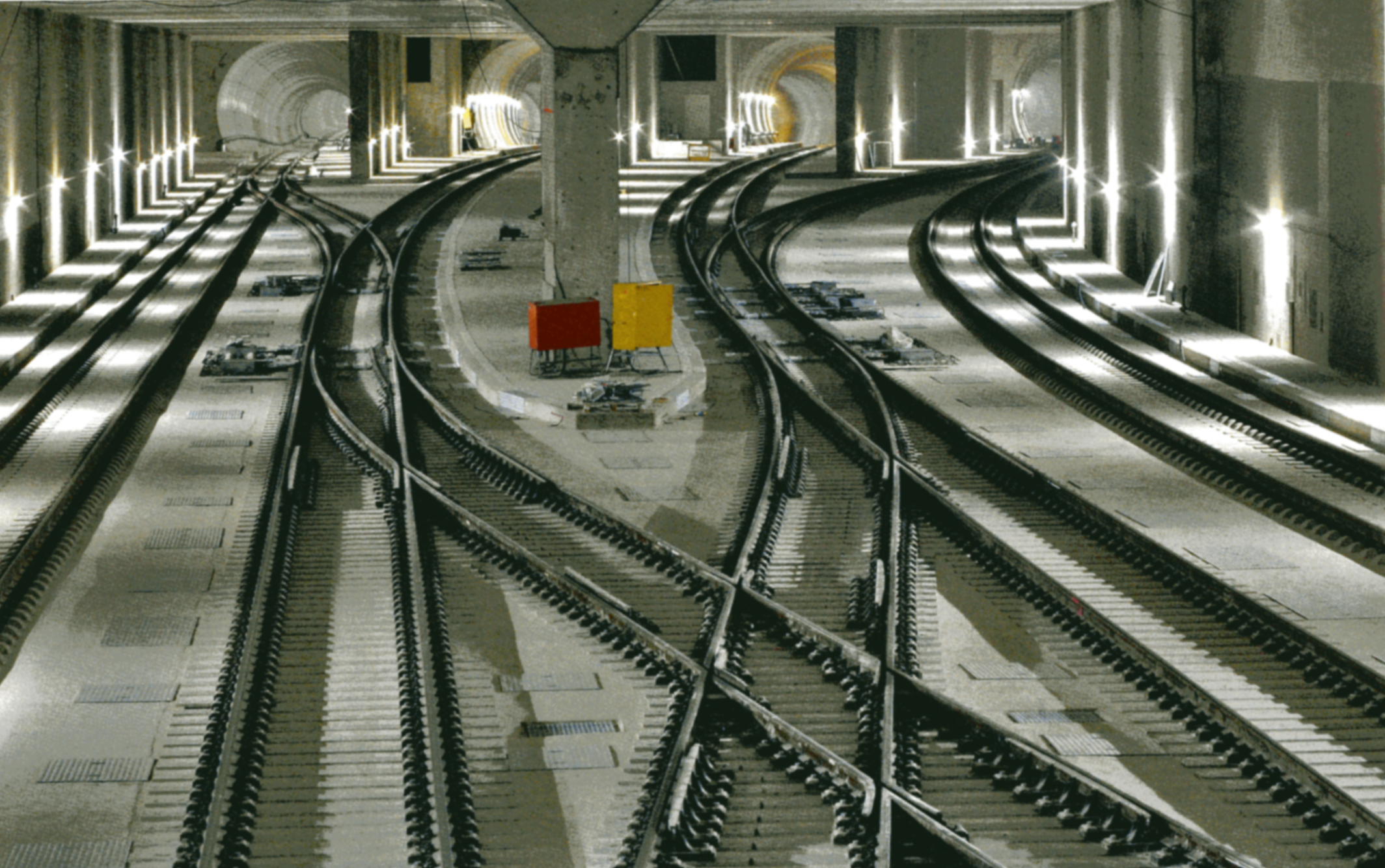
The inauguration of Berlin’s new Central Station on 28th May 2006 was a major event in railway engineering: For the first time in Berlin’s history, trains from all directions came together in one central point of intersection. In order to connect the lines from the north and south to the new crossing station, a 4.4 km long, four-track tunnel was constructed beneath Berlin’s Tiergarten park, the Spree River and the Landwehr Canal, using both cut-and-cover and mining techniques.
Following the tender process, SPACETEC was awarded a contract to survey and document the new north-south corridor.
Measurements
The client, Deutsche Bahn, requested high-resolution (10,000 pixels per 360° scan) image and profile recordings of all tunnel sections in order to document any defects or damage to the concrete surface, including cracks, spalling, holes and irregularities in block joints or installations.
The time frame for the project was 4 days, with measurements only taking place at night between the hours of 10:00 pm and 6:00 am. Since it was difficult to access the location with a measurement vehicle during the trial phase, a SPACETEC TS2 tunnel scanner was used.
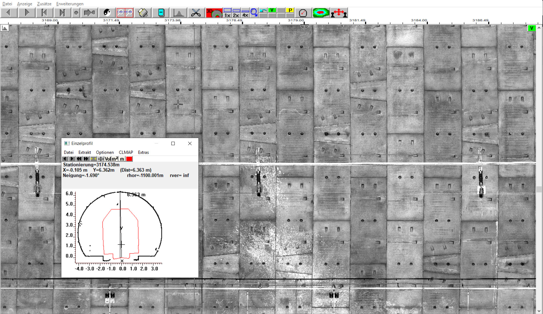
Evaluation
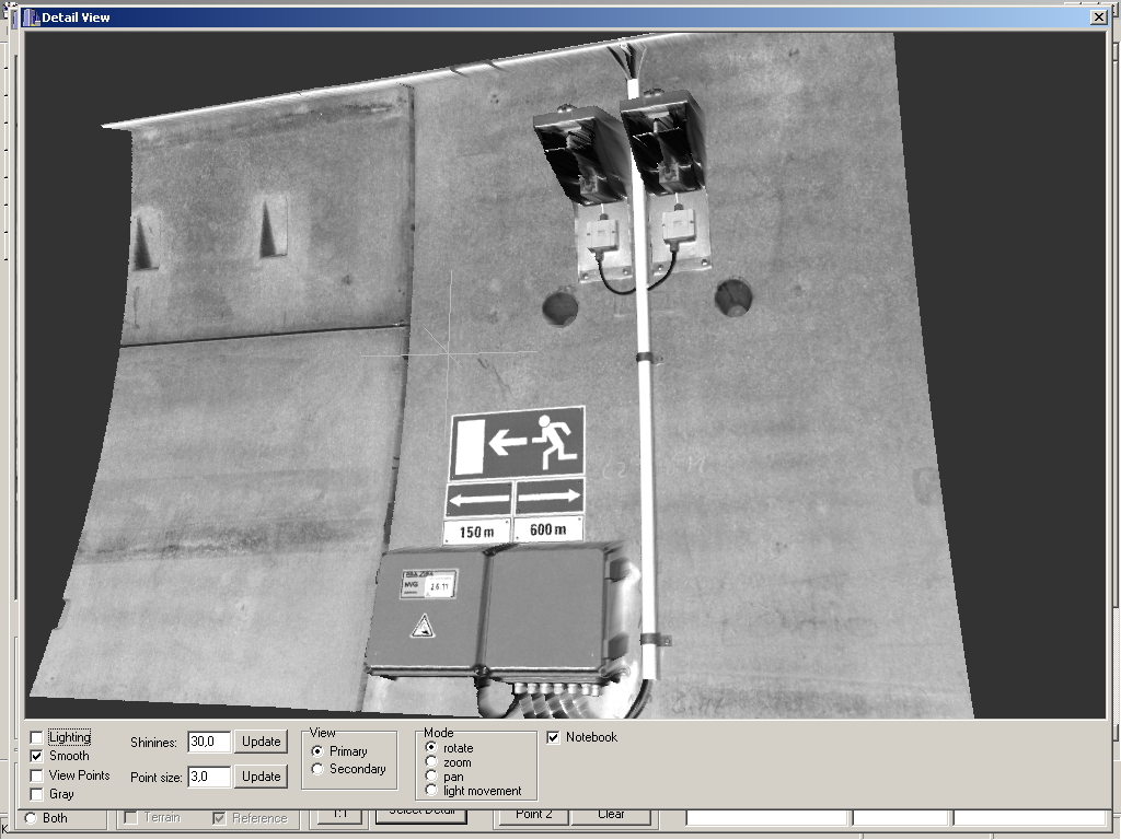
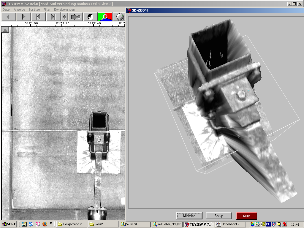
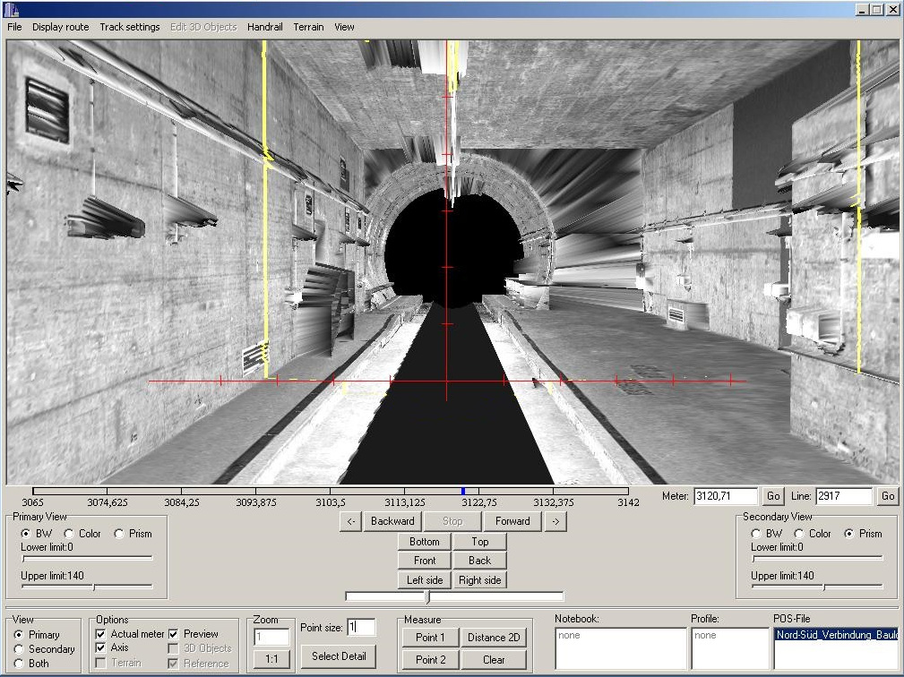
The screenshots demonstrate the various ways of visualising the scanner data:
- 2D development in TuView
- 3D zoom in TuView
- 3D passage through the tunnel in TuDrive
- 3D detail in TuDrive