New York: Tunnel inspection after hurricane Sandy damage
Client
New York City Transit Authority
Task definition
Tunnel inspection in the New York City Subway after the damage caused by Hurricane Sandy. Scan data was used to survey damage and plan restoration measures.
Measurement
- Recording with the SPACETEC TS3
- Distance scanned 5 km
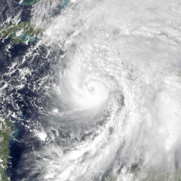
Tropical Storm Sandy
On 29 October 2012, Tropical Storm Sandy touched down on the east coast of the United States. It caused a storm surge with waves of up to seven metres in height. The storm surge also coincided with a spring tide, resulting in a record high water level on Manhattan’s shores. This resulted in flooded subway and railway tunnels, bringing traffic in one of the world’s most frequented public underground transport networks to a standstill.
Damage to tunnels under the East River
Both subway and railway tunnels were highly affected by flooding. Some parts of the tunnel system were even flooded up to the ceiling. The high salt content of the infiltrating seawater was a cause for concern, as it would likely lead to profound damage to the material of the tunnel lining as well as the fixtures.
Surveying
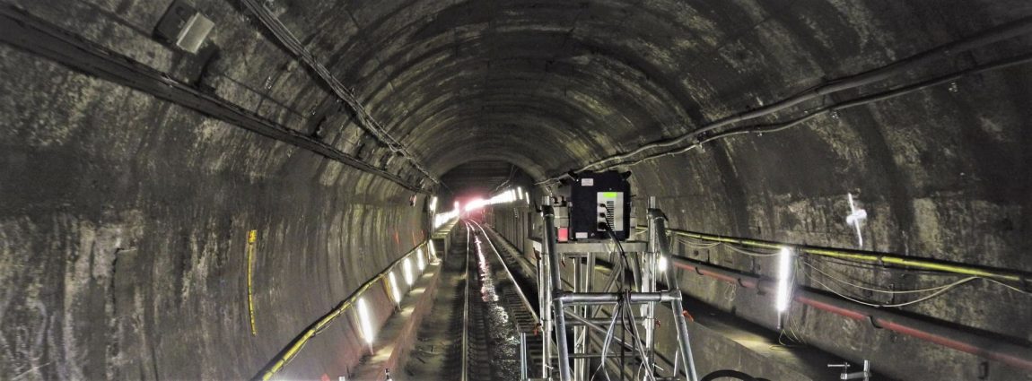
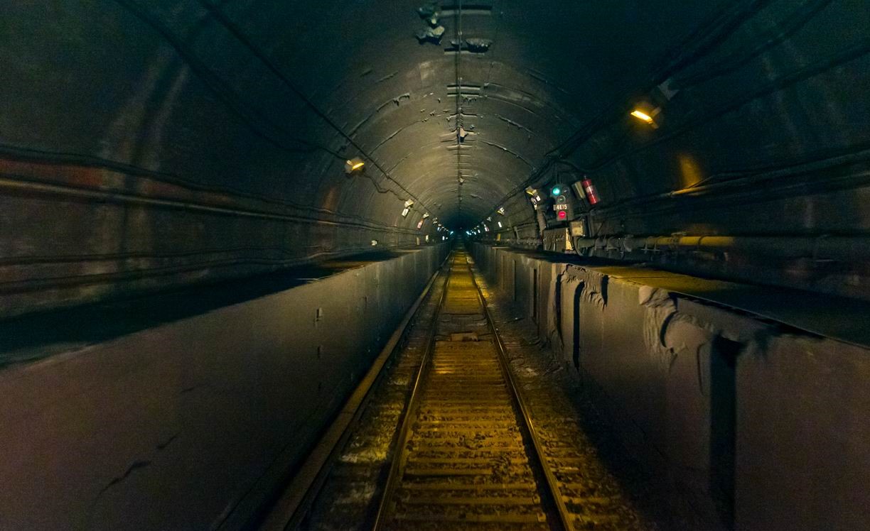
Planning repair work requires precise knowledge of the type, scope and position of the damage. The SPACETEC TS3 was employed to record the tunnels and offer an informative overview of the situation.
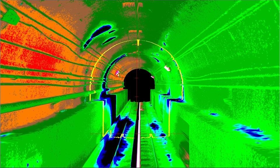
TS3 scan as the basis for the survey
The SPACETEC TS3 records the surface of the tunnel in high resolution in just one single passage, providing information in three different channels: an intensity image, a thermographic image and a 3D point cloud.
Only a short closure of the track section was required for the recording so that disruptions in operation were minimal.
The data generated helped provide a comprehensive overview of the structure’s condition. The high density of points made even the smallest of details such as cracks easily recognisable in the recordings.
.
Typical appearance in one photo
3D intensity image
3D thermographic image
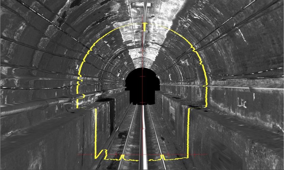
Using the data for surveying
The SPACETEC Tunnel Inspector software package was used for the damage mapping, marking any recognisable damage in the scan and quantitatively recording its type, position and size. This enabled any remaining necessary on-site inspections and thus track closures to be kept to a minimum.
Any spots that could not be clearly assessed on-screen were inspected more closely in the tunnel itself. Results from on-site inspections were then also included in the mapping.
The restoration of the damaged sections of tunnel is a highly complex task. The routes are driven so frequently that any closure over a longer period of time would lead to extreme problems. Having a complete and exact image of the condition of the tunnel system is an extremely helpful aid in this planning process. We are pleased to have been able to contribute to this work.

Sample image of damage mapping using Tunnel Inspector