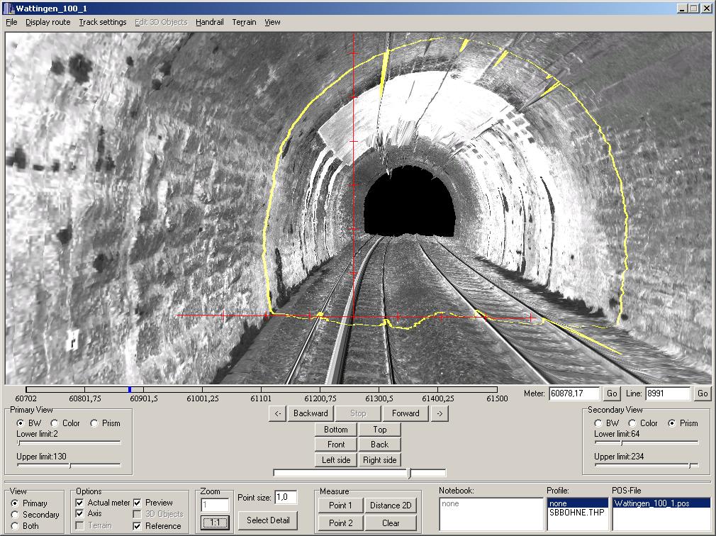
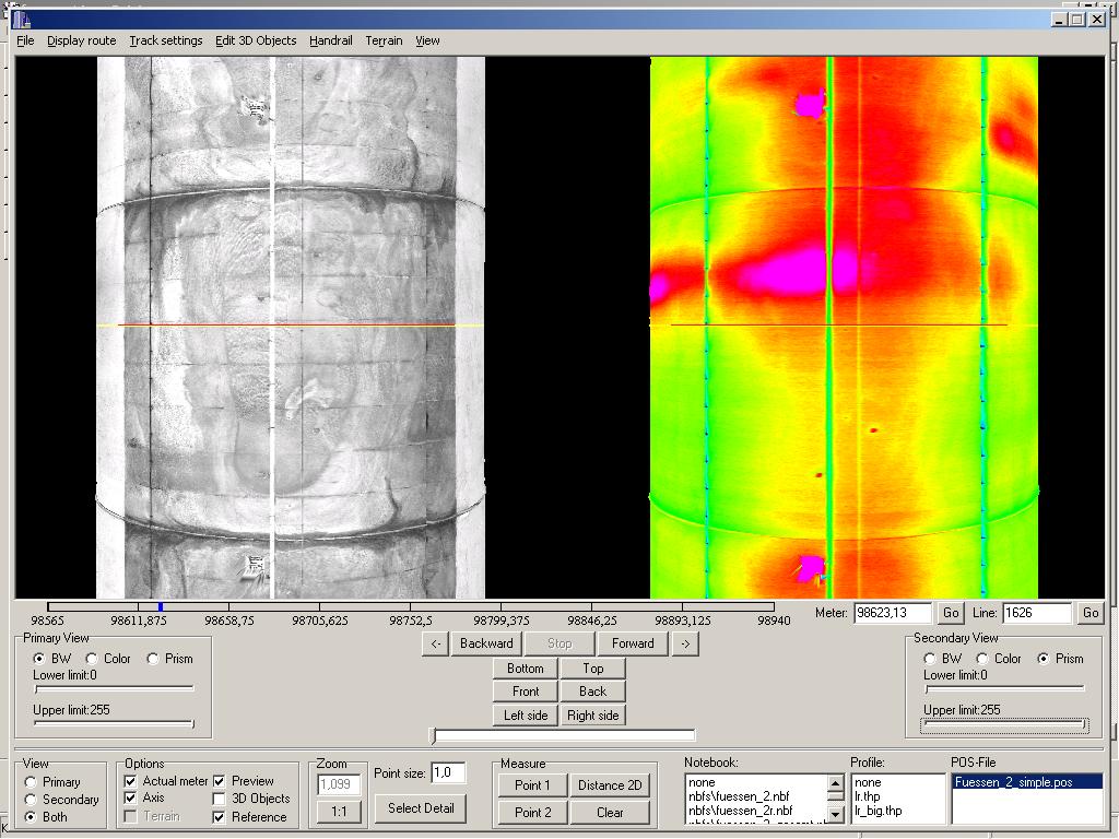
TuDrive – virtual tunnel inspection
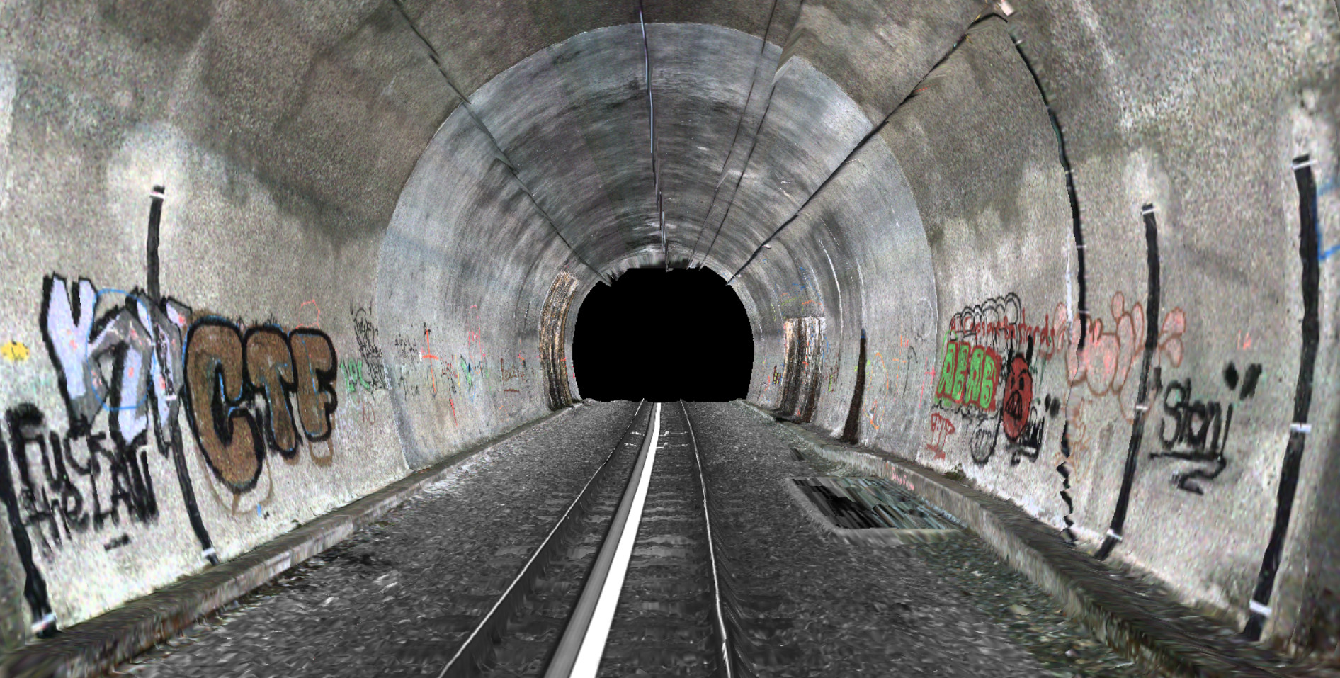
Many things are easier to assess if they can be viewed in 3D. This is not just true for CAD drawings, but also for scanned tunnel data. TuDrive allows the user to travel through the tunnel virtually in 3D. The program presents the data clearly and offers many other interesting and useful features.
Navigation
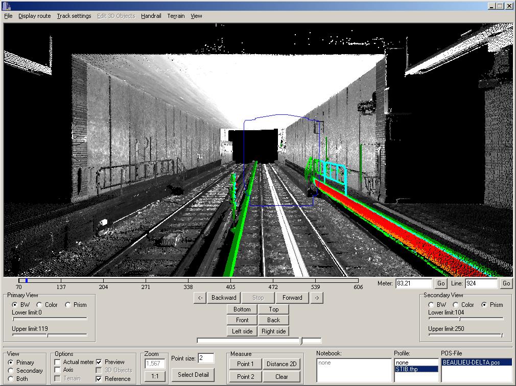
In TuDrive, the user can navigate through the data freely, e.g. travel forwards and backwards at varying speeds or jump to a specific point.
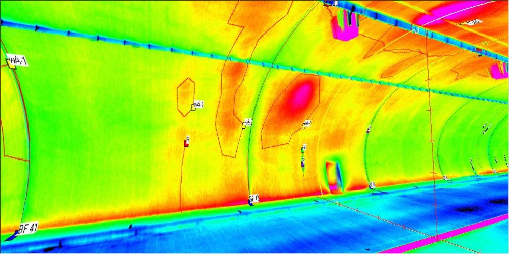
Visual and thermal data can be viewed separately or in parallel.
Movements can be predefined and then played back.
Visual and thermal data can be viewed separately or in parallel.
Viewing angle
The viewing angle can be freely selected using the mouse. Pre-set function keys are also available and include options to view the tunnel from above or from the side.
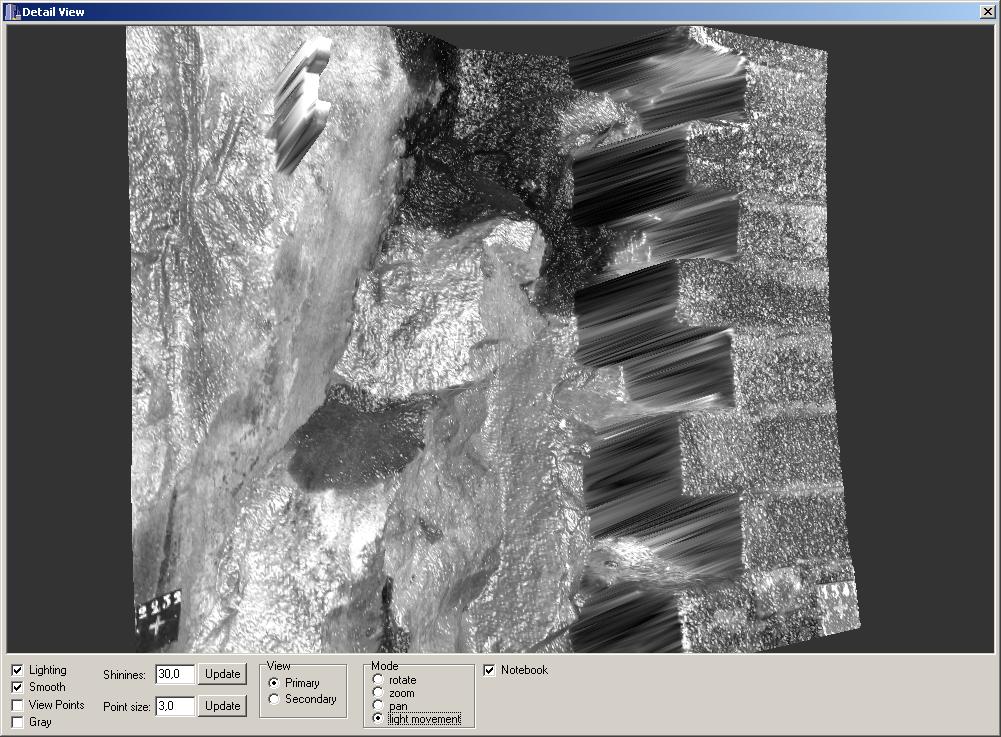
Detailed view
Details can be selected and viewed in full resolution.
Various options ensure that detailed views are optimally displayed, for example by changing the viewing angle or the lighting direction.
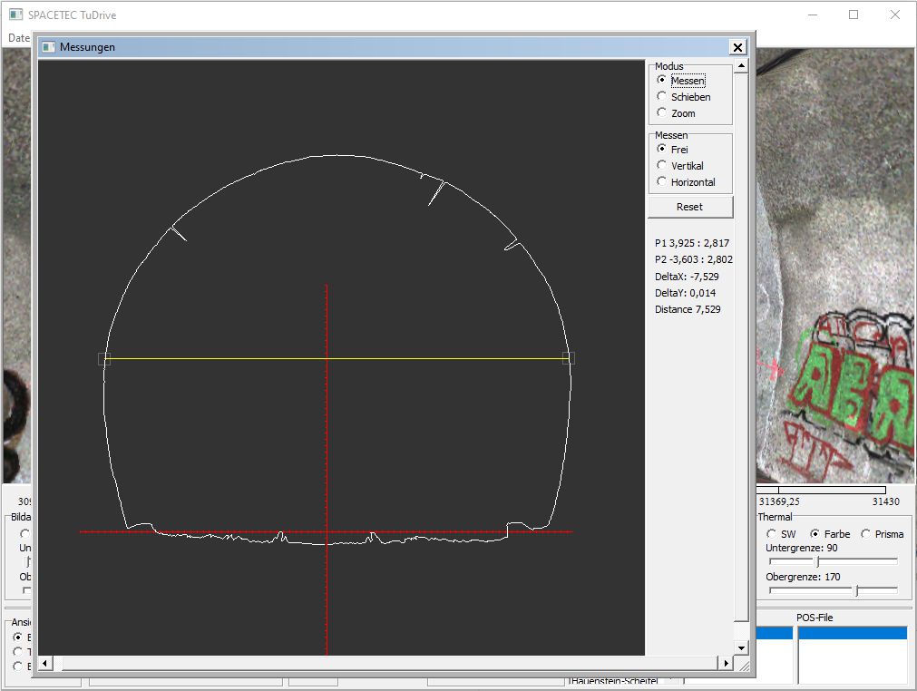
Measurements
The data allows for distance measurements,which can be made between any two points in the 3D image or in a separate profile cross section.
Overlays
Once the available scanner recordings have been analysed with TuView or Tunnel Inspector, they can be superimposed over the 3D data as an overlay.
The program allows for the definition of various layers.
Clearance profile maps
As in TuView, clearances can be checked against theoretical target profiles; for example, scanner data for a metro station can be compared to the profile of a new carriage model.
The results are presented in 3D, providing a clear picture, even for complex surfaces.
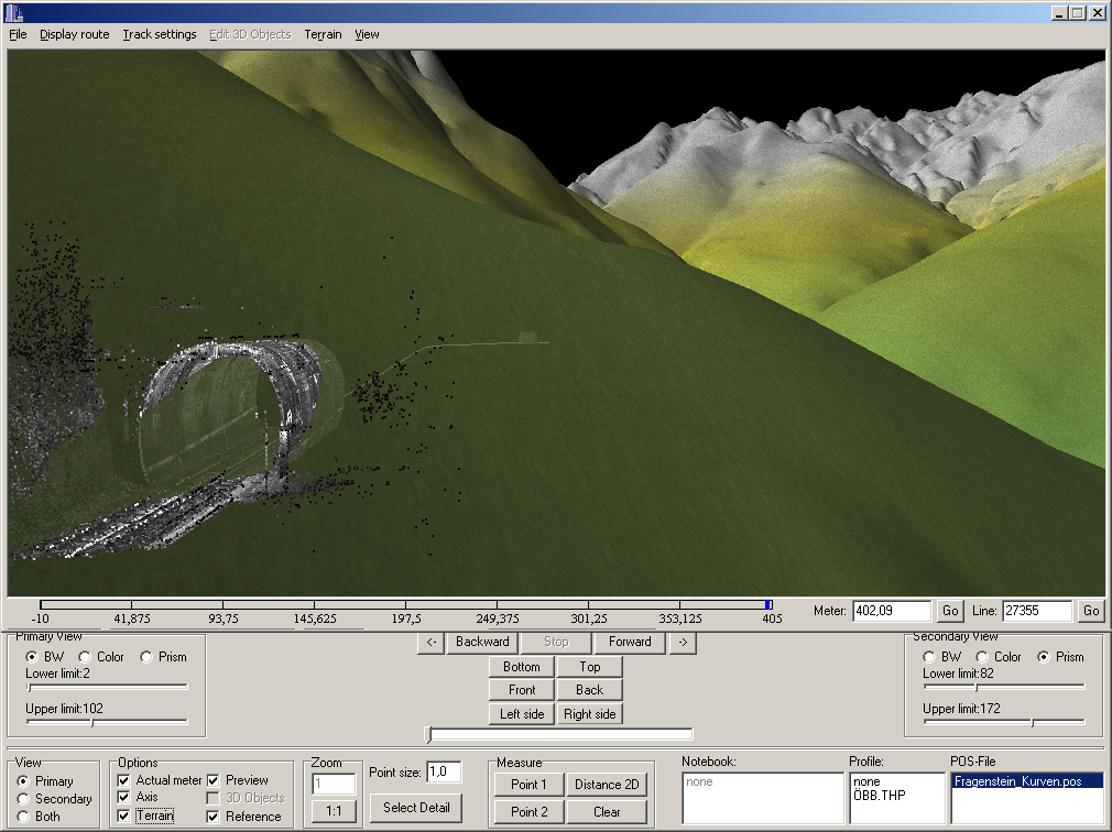
National coordinates
If additional geographical data allows for cross-referencing the tunnel data with national coordinates, the tunnel can be embedded in a digital elevation model.
Planning data can be analysed and integrated as a geo-referenced CAD model, making it possible, for example, to show where a connecting tunnel will penetrate the tunnel surface.