Milestones: 47 years of SPACETEC – 37 years of scanning tunnels
Founding of SPACETEC Datengewinnung GmbH
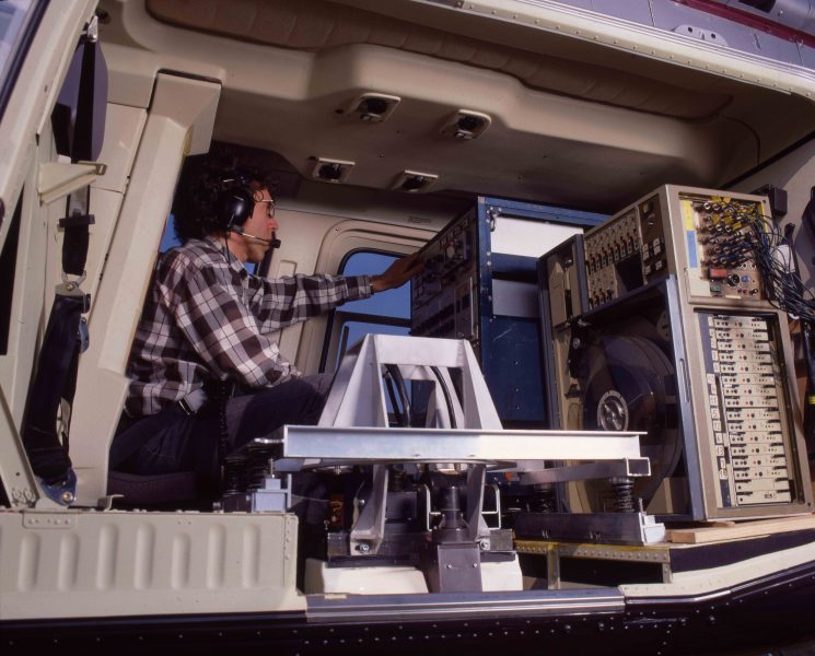
Remote sensing with a Daedalus multispectral scanner from aeroplanes and helicopters
Performing measurements for climate studies, as well as for special assignments:
- Landfill site investigations (anaerobic digestion processes)
- Mining waste heaps (smouldering fires)
- Rivers (groundwater discharges)
- Canal constructions (leaks)
Development of image processing software for each assignment
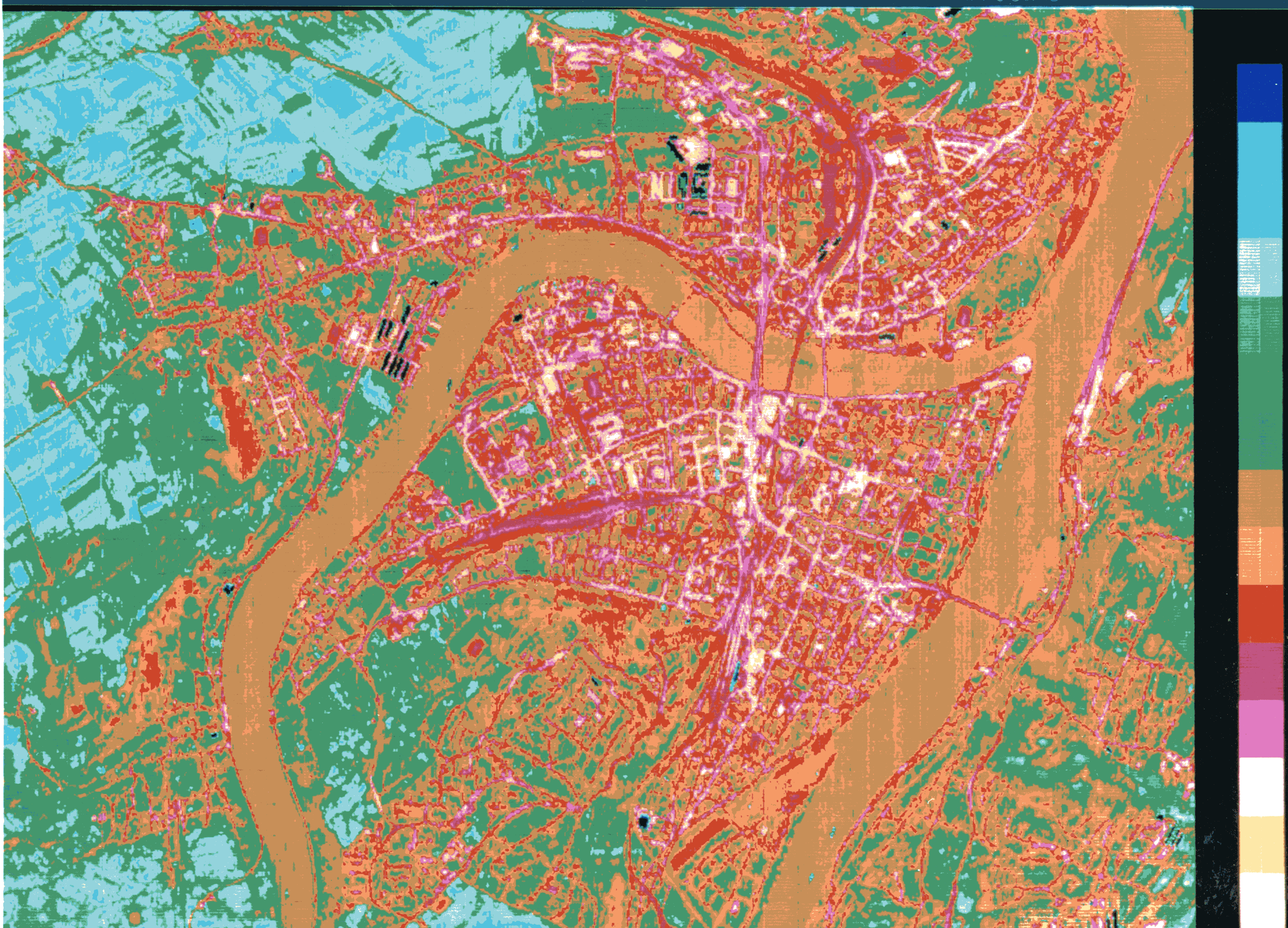
Applikation example: temperature difference map for an urban area
In this assignment, a scan flight over the target area was carried out in the morning and the evening, the scanned strips were merged and rectified on a map. In addition to the scan flight, other climate parameters were recorded on the ground.
The data collected is used to create a map detailing the cooling behaviour of the measured area, for instance in the summer.
Back then, we already required all the core competencies which are still needed for our work today: reliable measurement, precision data processing, software creation and interpretation of complex data.
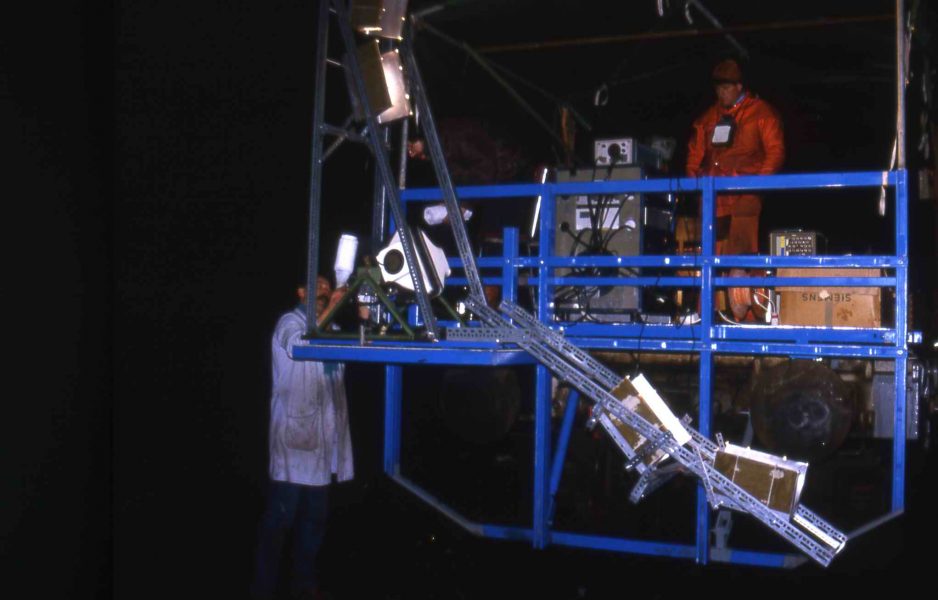
First use of scanner technology in tunnels
- Existing units adapted for these tasks
- Lighting equipment developed
- Scanners mounted onto railway vehicles
- Basic investigation conducted on the usability of thermal recordings for tunnel inspections
- Basic investigation conducted on the use of multispectral imaging for collecting visual information
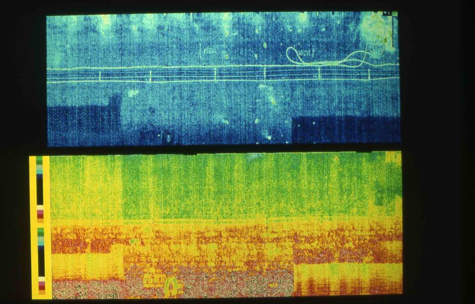
Research programme for the Swiss Federal Railways (SBB): invetigating tunnels with the help of scanner technology
- Over 30 km of tunnel measured and analysed
- Recordings made of infrared and multispectral data, in part with parallel video recordings
- Software developed for the geometric/radiometric correction of scanner data
- First operational applications in Germany, France and Switzerland
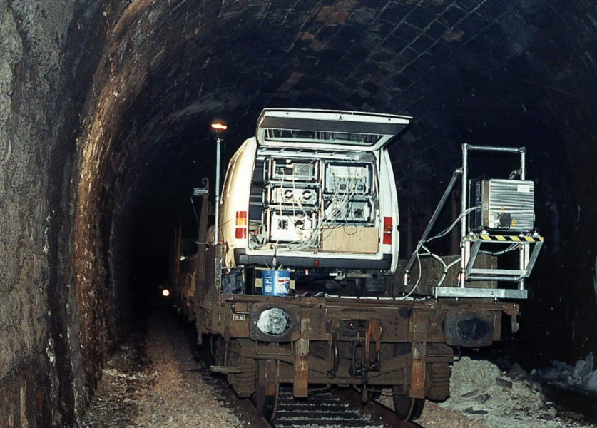
Start of in-house tunnel scanner development – first 360° thermography scanner
The scanner used initially was developed for use in aeroplanes and had a viewing angle of just 89°. As a result, two passages through a tunnel were required to record its vault. After the application proved useful, we began developing our own scanners with a 360° viewing angle.
The development of TuView, the universal visualisation and analysis programme for the SPACETEC scan data, was launched at the same time.
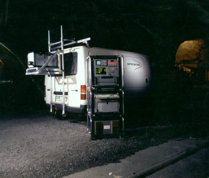
New types of scanner developed
- Two-channel (image/thermography), 2,500 pixels/360°
- Image capture, 5,000 pixels/360°
- Two-channel (image/profile), 2,500 pixels/360°
- Two-channel (image/profile), 5,000 pixels/360°
- Image capture, 10,000 pixels/360°
First use in road tunnels
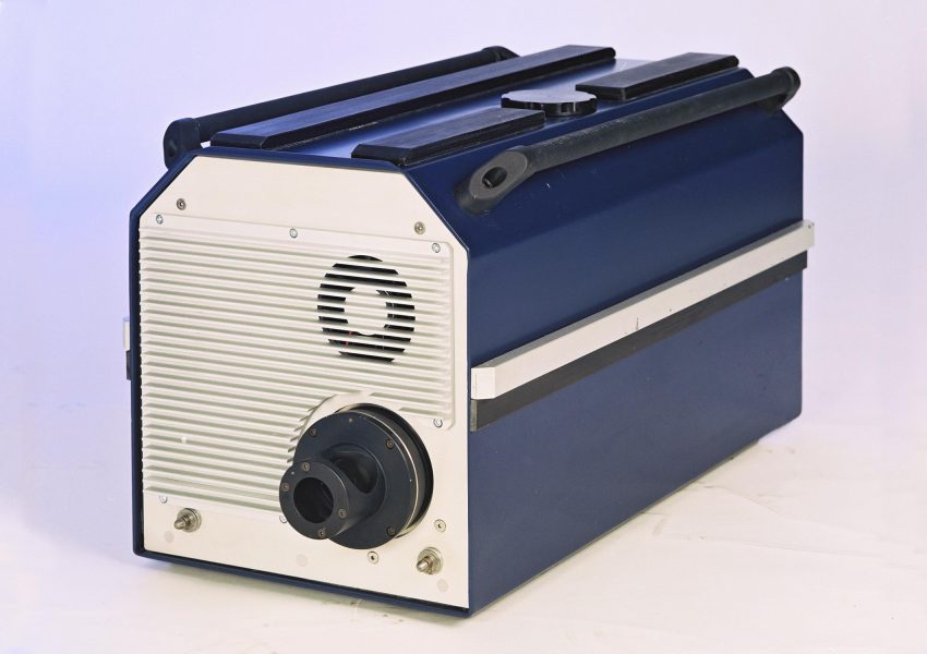
SPACETEC TS3: 360° three-channel scanner
This unit makes it possible to synchronously record visual, thermographic and profile data with a 10,000-pixel resolution in a single passage.
These devices have been used to record over 2,000 tunnels since March 2004.
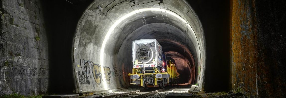
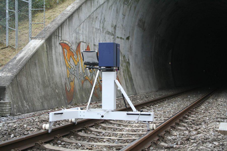
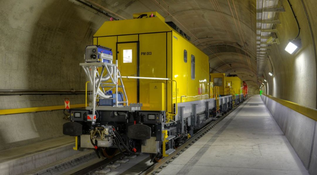
SPACETEC TS2: two-channel compact scanner (image/profile)
Mounted on a rail vehicle, this system was specially developed for railway applications.
TuDrive
TuDrive allows the user to virtually travel through tunnels in 3D. The program presents the data clearly and offers other functions for clearance analysis, surveying and simulations.
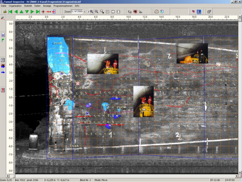
Tunnel-Inspector
Tunnel Inspector combines digital processes for collecting and processing information with the tried and tested methods of on-site structural inspection.
This equips test engineers with the tools to improve the efficiency and quality of their work.
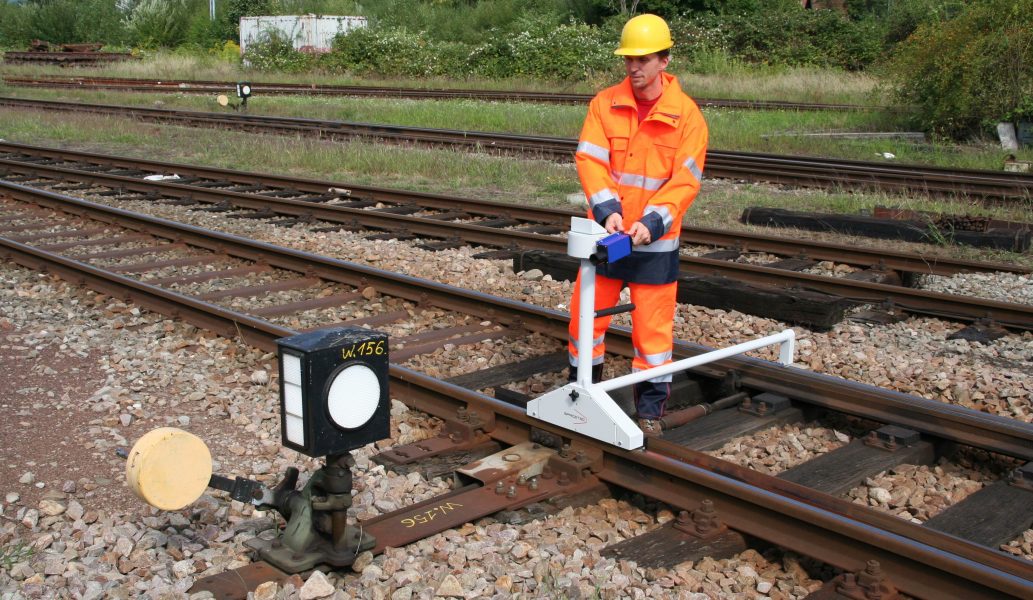
R2 measuring unit for inspecting objects close to the tracks
The SPACETEC R2 was developed for taking measurements at individual points along the track. The unit is placed on the track and used to measure distances and cants.
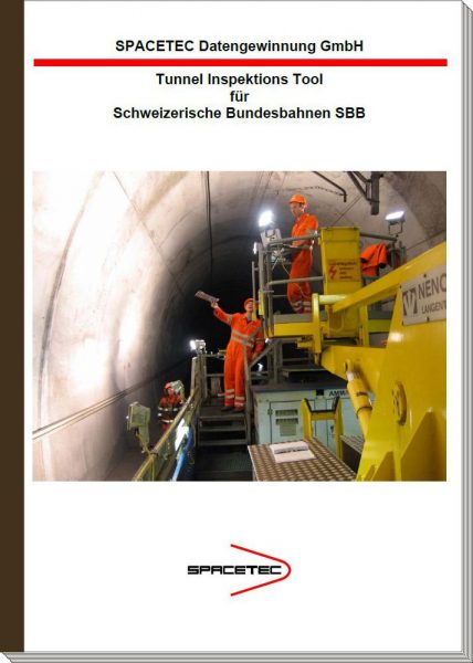
SBB chooses Tunnel Inspector
Following intensive preliminary considerations and an international call for tenders, Swiss Federal Railways (SBB) selected SPACETEC Tunnel Inspector as the support tool for their tunnel inspections.
Measuring the Gotthard Base Tunnel
TS4, initial commercial projects